Travel the Virgin Forests beside the Seaside City
Namtok Khao Chamao
Travel Info
From Rayong town, take Highway 3 and continue on Highway 3377 for 17 km You will see the sign pointing to the National Park on your right.
GPS Location
N12° 56.178’, E101° 43.791’
Contact
Khao Chamao – Khao Wong National Park
![]() +66 3889 4378
+66 3889 4378
Facilities & Services
Accommodation, tent camping sites, food, restroom and parking.
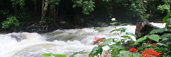
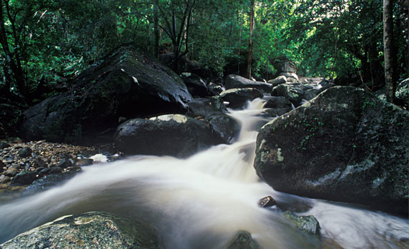
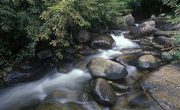
The stream originates from the Chamao mountaintop and flows for 3 km down 8 levels, which is moderately physically demanding. Each level has a distinctive beauty depending on its natural surroundings. The trail up the eight tiers of the waterfall cuts through a tropical broad-leaved evergreen forest and mixes exercise with relaxation.
The initial part is paved with concrete but the rest you will need to follow a sufficiently well-defined trail and hop from rock to rock. Along the way, you will see colourful butterflies and big dipterocarp trees more than a hundred years old. Carp can be found in all levels of the stream. It takes about two hours to get to the top-most level.
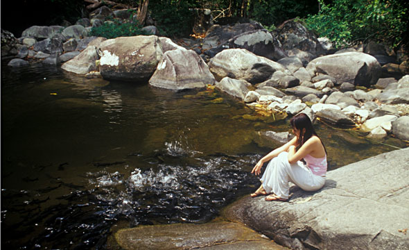
First level – Wang Nueng is a stream flowing through rocks, large and small similarly to rapids of a river, with basins in various places.
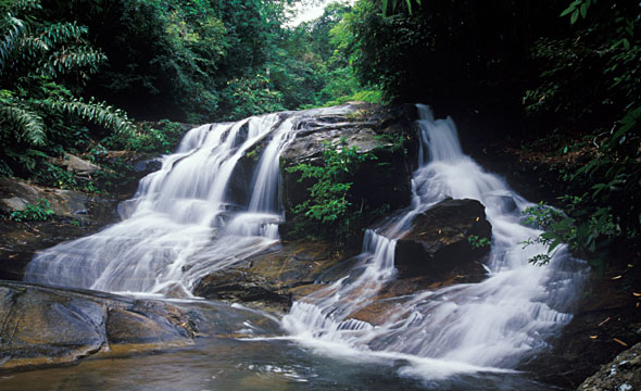
Second level – Wang Matcha It is the highlight of this destination. It is
a large and deep basin and home to numerous carp. A waterfall flows down from the northern side of the basin. Tourists can feed the carp and view the scenery from the rope bridge here.
Third level – Wang Morakot It is a clear, emerald green basin like a natural swimming pool. At the end of a pool is a large slated rock that you can lay down upon and have the waterfall bathe you.
Fourth level – Wang Sai Ngam It is a relatively deep basin surrounded by banyan trees.
Fifth level – Pha Kluamai During the early months of the year the various orchids on the cliff will bloom.
Sixth level – Chong Khaep The waterway in this area flows in a narrow channel between many layers of rock.
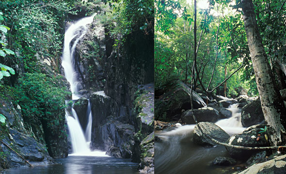
Seventh level – Hok Sai This level has a water fall 7 m high. During the dry season the water falls in 6 different paths. You can enter the basin at the bottom and enjoy the cool refreshing water.
Eighth level – Pha Sung The final level of the stream. It is the highest point of the waterfall situated 1 km away from level 7. The trail is quite rugged. When you get there, you will see water flowing down from the tall mountain covering the entire area with mist.
Know Before You Go
"If the water changes colour or flows more quickly, or if you hear the warning signal, leave the water and find a safe area because it may be a signal of an incoming
flash flood."
Suggestions
"Stop by Heaven Cliff, a scenic area that is 1.5 km to the north of the National Park office. The trail leading to Heaven Cliff goes through bamboo forest and cycad trees. When the sky is clear, you can clearly see the Ko Samet from here."